Agricultural map
|
Agricultural Map |
|
|
Connection with the application Documents |
|
|
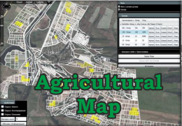
Automatic mapping and visualization of properties inculded in contracts |
|
|
view property by estate map on padding of satellite images |
|
|
Property Information - permanent usage, area, arable area |
|
|
Information about the contract with the tenant |
|
|
Drawing fields ticking points on the map |
|
|
Drawing fields by merging estate |
|
|
Drawing massifs by importing outline in shp or kml format from the GPS device |
|
|
Editing fields |
|
|
Import of shp и kml files |
|
|
Calculating sections between layers |
|
|
Export to SHP and KML files for transmission into navigation systems |
|
